Surveying today has become one of the most forward-looking segments of the geospatial industry. The technological advancements in the land survey equipment industry allow surveyors to take measurements and report data with increased speed and accuracy. Moreover, companies are increasingly adopting 3D laser scanning technology to reduce the overall risks and project costs involved in surveying and mapping. “You can’t have old, antiquated equipment and still compete to continue leading the market. It is all about staying up with the latest technology and equipment and being able to do things more efficiently with the present technology. That’s what we are all about,” asserts Trent J. Keenan, Founder & President of Diamondback Land Surveying.
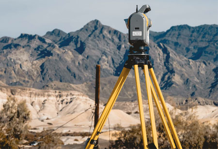
Founded in 2008, Diamondback Land Surveying provides complete surveying, mapping, and construction staking solutions for residential, commercial, as well as public works projects. Today, they are a renowned name in the industry known for their quality services in boundary and cadastral surveys, building, utility, and water rights surveys, ALTA/NSPS Surveys, topographic and photogrammetric surveys, primary control and engineering design surveys, and construction staking surveys—Diamondback Land Surveying offers all land surveying applications. With the help of their expert mapping team, Diamondback Land Surveying provides effective commercial subdivision and plat mapping, easements, and legal document preparation. Besides this, for a better topographical survey, the company utilizes the industry-leading FARO Laser Scanner Focus 3D, as well as the Trimble’s new lightning SX10 to provide complete high definition 3D laser scanning services. Recently, Diamondback Land Surveying utilized this while performing the retrofitting on a pipe over a big salt tank in a solar plant. As a result, the company easily provided a 3D model as-built survey of that existing interior tank.
“We utilize the most current technology, including GPS and high definition 3D laser scanning coupled with our team expertise and extensive knowledge to offer quality services,” states Keenan.
From energy, wireless, educational, commercial, residential, to the environmental project, the company has built a proven track record of successful projects. For instance, the company effectively completed the project to survey Utah’s Sevier Lake bed for a potential mineral lease. The project required the layout of 7 townships of BLM (Bureau of Land Management) land in Central Utah. The overall objective was to stake out 467 corners from coordinates provided by BLM Cadastral and take a GPS observation on every monument set in the ground. The surveyors were also required to take a picture of every aluminum cap to document the correct markings and fill out a corner monumentation worksheet for each corner. This project, spanned in 86,400 acreage areas with total section line mileage over 250, was completed in just 16 days.
As a PLS, WRS, CFedS with over 25 years of land surveying experience within a wide range of residential, commercial, and public works projects, Keenan has been the major driving force of the company. He cites the company’s qualified team professionals are their major asset.
Touching upon the company’s upcoming endeavors, Keenan highlights that the company has recently been awarded a few hundred Tesla charging stations throughout the west coast. “By consistently providing top-notch services to our clients, our emphasis is on providing on-time service that maintains an excellent reputation in the construction and development communities,” explains Keenan.


